The official starting point of the Eger Cycle Route is located in the forests of the German Fichtelgebirge mountain range. If you want to ride the entire route from its actual starting point (see Stage 1 here), you’re in for a great cycling adventure. Below you’ll find a clear guide on how to comfortably reach the source by public transportation or with your own bike.
1. By train to Marktredwitz
The best starting point for the trip from the Czech side is Cheb.
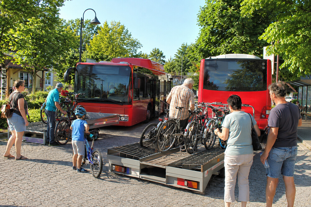
2. Weekend Bike Bus: Main-Eger-Express (Line 1728) from Marktredwitz to Bischofsgrün (below the source)
On weekends, you can continue your journey from Marktredwitz with your bike using this seasonal tourist route.
3. Cycling from Bischofsgrün to the Source of the Eger
After getting off the bike bus in Bischofsgrün, a short but scenic ride awaits you to the source of the Eger River (Egerquelle)—a map of the route from the bike bus stop to the source is available here.
The route from Bischofsgrün to the source of the Eger River is approximately 6.8 kilometers long. Due to the gentle incline through the forest, the ride will take you about 35 minutes. The route takes you through the Smrčin forest (past the Goldkronacher-Sträßchen area) to the well-maintained stone spring. You can view the entire route in detail on Mapy.cz.
From there, you can smoothly begin riding downstream and connect to the official start of the Eger Cycle Trail toward the Czech Republic.
If you’re traveling on a weekday, the weekend bike bus with a trailer does not run. You’ll need to make your own way to the spring from the direct train from Cheb, either on your own or with one train transfer.
1. By bike only from Marktredwitz (approx. 33 km)
The most reliable option, where you don’t have to rely on any additional transfers. Get off the direct train from Cheb at the main station in Marktredwitz. From there, follow the marked bike trail through the town of Wunsiedel to the lake and on to the town of Bad Weißenstadt. From there, it’s the final 6 kilometers uphill through the forest. The route is 33 kilometers long with a total elevation gain of about 420 meters. Map here.
2. With a train transfer to Marktleuthen (about 23 km by bike)
If you want to shorten the distance you’ll ride, transfer in Marktredwitz to a connecting German regional train. Ride two stops and get off in the town of Marktleuthen. From there, cycle through the villages of Röslau and Weißenstadt. From this train station, it’s about 23 kilometers to the spring, with an elevation gain of about 270 meters. Map here.
3. Combination: Train + Regular Bus (Last Option – approx. 6 km by bike) – for individual travelers only (not groups)
On weekdays, from the train station in Marktredwitz, you can transfer to regular bus line 1707 (operated by VGF, heading toward Gefrees), which will take you to the Bad Weißenstadt, Kirche stop. From there, it’s just a 6-kilometer climb to the spring, but be aware of bike transport restrictions. Route 1707 is a standard city/regional bus without a bike trailer. According to VGN’s official terms of service, bicycles may only be transported in the aisle on these buses and only if there is space available. Strollers and wheelchairs always have absolute priority. If the bus is full or you encounter a strict driver, they will not let you board with your bike. This may be a stopgap solution for a single cyclist, but it’s not feasible for a group of people.
The official starting point of the Eger Cycle Route is located in the forests of the German Fichtelgebirge mountain range. If you want to ride the entire route from its...
Show moreThe Eger River is legendary among paddlers primarily because, unlike other Czech rivers, it flows beautifully and you’ll rarely encounter boring, stagnant stretches (“oleje”). The navigable section on Czech territory...
Show more